
Most agencies target who. We target who, where, and what's around them — simultaneously, in real-time, across every campaign you run.
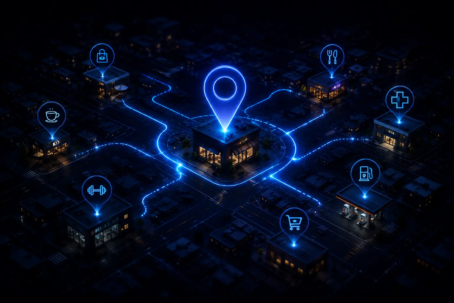
The Geo-Intelligence Layer is the foundation of Signal & Scale's GeoMind platform. It fuses data from 47 geographic sources — from OpenStreetMap and foot traffic APIs to weather patterns, local events, and competitor density — into a single, unified intelligence layer that powers every campaign decision.
Lorem Ipsum is simply dummy text of the printing and typesetting industry. Lorem Ipsum has been the industry's standard dummy text ever since the 1500s, when an unknown printer took a galley of type and scrambled it to make a type specimen book. It has survived not only five centuries, but also the leap into electronic typesetting, remaining essentially unchanged. It was popularised in the 1960s with the release of Letraset sheets containing Lorem Ipsum passages, and more recently with desktop publishing software like Aldus PageMaker including versions of Lorem Ipsum.
GeoMind fuses 47 data sources into a single spatial layer — giving your brand a structural advantage that compounds over time. See your market clearly. Move faster than competitors. Win the zones they haven't even found yet.
GeoMind analyses every business address in NZ & AU against 47 spatial variables — surfacing the exact opportunities your competitors haven't found yet.
See Our Portfolio →GeoMind ingests data from 47 sources — OpenStreetMap, mobility APIs, census data, retail foot-traffic feeds, local business directories, weather APIs, and event calendars. Every location relevant to your brand is loaded into a unified spatial model within 48 hours of onboarding.
The AI cross-references your historical conversion data with spatial signals to surface the specific suburbs, precincts, and micro-zones where your next customers are most likely to be — and highlights the white space your competitors haven't claimed yet.
Your Google, Meta, TikTok, and programmatic campaigns receive continuous geo-intelligence updates. Bid adjustments, audience radii, creative variants, and targeting parameters are refined every 60 seconds based on what GeoMind sees happening in the physical world around your customers.

Your GeoMind dashboard gives you a live map of campaign performance layered over your geographic opportunity landscape. See ROAS by suburb, conversion density by zone, and competitor movement — all in one screen, updated in real-time.
 01
ACTIVE
02
03
01
ACTIVE
02
03
 04
04
 05
05
 06
06
 07
07
 08
08
 09
09
 10
10
 11
11
 12
12
 13
14
01
ACTIVE
02
03
04
05
06
07
08
09
10
11
12
13
14
13
14
01
ACTIVE
02
03
04
05
06
07
08
09
10
11
12
13
14
14-day free trial. No credit card. No lock-in. Start with a free Geo Intelligence Scan of your business — see what we can see before you commit to anything.
Pricing correct as of May 2026. All prices NZD excl. GST